Chapter 6: Jokes and Seriousness
Life in America
In January 2013, I left Japan, which had accepted and nurtured me since I was nine years old, and finally moved to California’s Silicon Valley, a place I had long aspired to live. Through a colleague’s introduction, I began sharing a house with two roommates in Sunnyvale, a city near Google’s headquarters. Room sharing is very common in America. Especially in San Francisco and Silicon Valley, where rents have been rising in recent years, it’s too burdensome to rent alone, so it’s normal for single young people to share accommodations. The house where I started room sharing was a three-story townhouse, with the second-floor living room and kitchen as shared spaces, and individual rooms each with their own bath and toilet. Since it’s impossible to get around the Silicon Valley area without a car, I acquired a used car for $5,000 (about 600,000 yen) from a JAXA (Japan Aerospace Exploration Agency) employee I found through an online Japanese community. While private car transactions are common in America, as I wasn’t yet familiar with local circumstances, I decided to buy from a Japanese person for peace of mind.
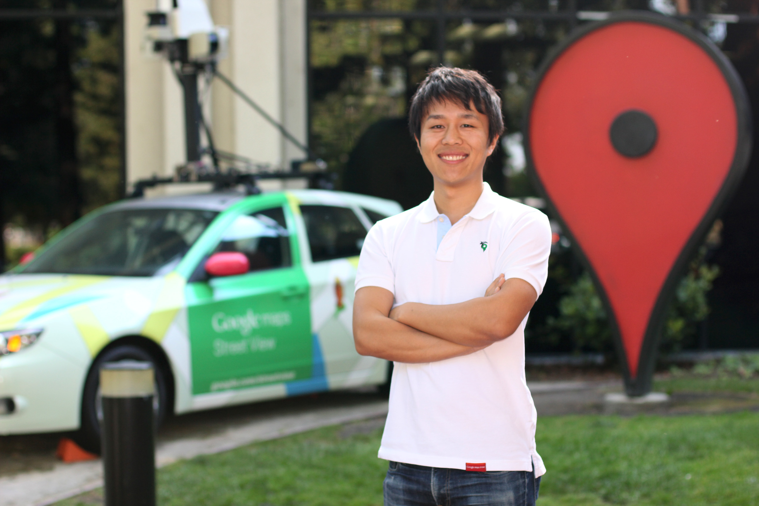 In front of GWC1. Wearing a Google Maps 8-bit polo shirt
It was about a 20-minute drive from my house to the office in Mountain View, and I commuted every morning while listening to Chinese radio broadcasts. There are so many Chinese people living in this area that they have their own Chinese radio channels. As I drove along my commute route, I passed by NASA’s Ames Research Center. The large NASA logo, which I had only seen in movies before, always reminded me that I was in America. Exiting Route 101 onto Shoreline Boulevard, past the Computer History Museum, Google’s headquarters campus spreads out. Google’s campus is located on a vast site of about 50,000 square meters, like a university campus. Within the grounds surrounded by greenery, dozens of low-rise office buildings are scattered. Near each office, there are colorful bicycles called “G-bikes” that you can ride when moving around. Most buildings have one or two cafeterias where employees can eat breakfast, lunch, and dinner for free. I was in an old two-story building called GWC1, where the Google Maps team was gathered. At the entrance of the office, there was a Google Street View car on display, and inside, there were game corners, billiards corners, and “micro kitchens” with drinks and fruits always available. My desk was in a six-person booth in a large room right next to the game corner on the second floor. The large desk, which had plenty of space even with two display monitors and a laptop, was decorated according to each person’s taste. Kawai-san (Keiichi Kawai), a product manager leading the Street View team who would later become my boss at Niantic, was also on the first floor of the same office. Although I had visited this office several times on business trips before, so there was no surprise, it was deeply moving to think that this would be my new workplace.
Treasure Hunt
About a month after coming to America, just as my life was beginning to settle down, I started planning for the 2013 April Fools’ project. After brainstorming various ideas with my American colleagues, we decided on the idea of making Google Maps look like a treasure map. I quickly made a demo in a few hours and showed it around to find people who would help me. I was overconfident that it would go smoothly because I had learned from the “Google Maps 8-bit” experience and knew the process to some extent, but it didn’t go that way. I can’t go into details here, but due to various circumstances, we couldn’t use the same system we had used the previous year. With the help of people from various teams, we rebuilt it with a different system from the previous year. On April 1, 2013, I posted a blog titled “Introducing ‘Treasure Hunt Mode’ in Google Maps – Solve Codes and Find Treasures1,” and during that year’s April Fools’ period, Google Maps became a treasure map.
Global Environment
Silicon Valley is truly a multinational place. White Americans, of course, along with Chinese, Indians, Europeans, Canadians, Russians, and various other ethnicities intermingle. There are also Japanese and Japanese Americans, not in large numbers, but scattered around. The team I belonged to included Japanese, Indian, British, Chinese, American, and Russian members. The common language was, of course, English, but everyone had their own distinctive accent. Although my English had improved somewhat from before and I had no problems at all in daily work, I often couldn’t catch everything when discussions heated up in meetings. In America, it’s common for the next person to start speaking before the previous person has finished when having discussions, so you need to keep up with that pace. There were many times when I hesitated to speak, and by the time I decided to, the topic had already moved on, leaving me to bite my nails in regret. Work-related English is still relatively easier to understand because it involves specialized conversations, but casual conversations during meals were even more challenging as topics ranged widely from TV, history, culture, to politics. Although I had learned Japanese in just half a year when I was nine, my English was still immature despite studying it for over ten years.
To compensate for my language disadvantage, I threw myself into work more than others. Unlike typical Japanese companies, at Google, you’re not evaluated by how long you work, nor is anyone going to praise you for working late. Many people prioritize work-life balance, and many have families, so most people leave around 6 PM. People who work late are often looked at with curiosity. I worked hard not to impress my bosses or colleagues, but because I loved the work and programming. It was like getting paid to do what I loved. As I worked diligently, my knowledge gradually increased, and I almost single-handedly created the layout and rendering program for road names and place names, which is one of the important features of the Android version of Google Maps. Road names and place names are also called “labels,” and laying them out and rendering them properly is a fairly challenging problem. Especially in the mobile version of the map, since the screen rotates or tilts, such as in navigation mode, it’s necessary to display the optimal label at the optimal position in real-time. I made various innovations for the algorithm to achieve this. Through such efforts, I gradually gained the trust of the team.
Collection Games
In December 2013, as I was approaching my first year in the United States, I received a video conference request from Taj, Fujiwara-san, and Sawa-san from the Google Maps team in Japan. Video conferencing is routinely used at Google, and it’s indispensable for communication across the Pacific. They approached me about next year’s April Fools’ Day project. At that time, I had publicly declared to those around me that I wouldn’t do it next year, having led April Fools’ projects for two consecutive years with considerable hardship. Agreeing to “just brainstorm ideas,” I had a brainstorming session with the three of them. Brainstorming is when everyone gathers to share ideas, and it’s the first step when starting a new project. Various ideas emerged in that day’s meeting. In particular, Fujiwara-san’s idea of “collecting regional Hello Kitty characters” seemed interesting, so we decided to pursue that direction. The image was that on Google Maps, you would find an Okinawa Hello Kitty in Okinawa, a San Francisco Hello Kitty in San Francisco, and so on. It was right around the end of the year, and I was planning to return to Japan the following week, so we decided to meet again when I was back in Japan. A week passed, and after returning to Japan, I was staying at a friend’s place in Hamamatsucho. I commuted from Hamamatsucho to Roppongi, where the Google office was located. On this day, I discussed ideas again with product manager Taj, engineers Fujiwara-san and Sawa-san, and designer Peter. Following up on the previous discussion, we continued talking about collection games, starting with Hello Kitty. Other ideas came up too, such as “collecting Dragon Balls would be fun.” At that moment, I suddenly remembered the “Pokémon Center” (which moved to Ikebukuro in December 2014) in Hamamatsucho that I passed every day during my commute, and came up with the idea: “That’s it! Collecting Pokémon on Google Maps!” Thinking “this is definitely going to be fun,” I returned to my desk in excitement and immediately created a demo.
By that time, I had been developing the mobile version of Google Maps for nearly a year and knew the Google Maps program well, so the demo was completed in about two hours. In this demo, when you zoomed in on Google Maps, Pikachu would appear, and by tapping on it, you could catch it with a Poké Ball. It was simple but sufficient to convey the idea to everyone. I enthusiastically showed the completed demo to everyone, and seeing their reactions, I was convinced this would definitely succeed. Thus, the “Google Maps Pokémon Challenge” project was launched.
When starting something new, it’s very important to create a simple demo. It’s very difficult to explain an idea to someone using only words and have them understand. I think it’s important to give form to your ideas using whatever method you can—creating a working demo if you can program, or drawing a picture if you can’t program.
A Series of Coincidences
Although we were excited about making a game where you catch Pokémon on Google Maps, we naturally needed permission from the rights holders of Pokémon. When researching about Pokémon rights, “The Pokémon Company” (hereinafter Pokémon Co.) came up. It was then that I first learned there was a company with the name Pokémon. In a stroke of serendipity, Pokémon Co. was located in the Roppongi Hills Mori Tower, the very same building that housed the Google office. This unexpected proximity felt like a fortuitous alignment of stars, setting the stage for what would become a remarkable collaboration. However, I couldn’t just approach Pokémon Co. out of the blue, so I went to consult with Negoro-san from the marketing department, who had been helping with April Fools’ promotions every year. Negoro-san supported the project but didn’t have any connections with Pokémon Co., so he sent an email to the internal mailing list asking if anyone knew someone at Pokémon Co., without revealing the content of the project. Among multiple replies, there was one familiar name: “Kento Suga.” Negoro-san simply added me to the cc of his reply without saying anything. Suga-san, who had been working as hard as I had on April Fools’ projects every year, initially thought “Oh no, here we go again” when he saw my name, but he resigned himself to help, thinking “It can’t be helped, it’s my destiny.” Through Suga-san’s acquaintance, we were able to arrange a meeting with Pokémon Co. and gain their support for the project. Thus, through several strokes of luck, it was decided that the 2014 April Fools’ project would be Pokémon.
Come Forth, True Pokémon Masters
After reaching out to various engineers within the company, a volunteer team was formed, centered around Fujiwara-san, Sawa-san, Tyson, and myself. Since we needed to support both Android and iOS versions of Google Maps, the total number of engineers involved in the project exceeded 20. Taj served as the product manager, and Peter handled the design. After discussions with everyone, we decided to make a game where you could catch 151 types of Pokémon found around the world as you zoomed in on the map. We also prepared a Pokédex, which would be filled as you caught Pokémon. Pokémon Co. selected 151 Pokémon from across all the series to appear in the game. The locations where Pokémon appeared were set at famous places around the world and places with terrain where Pokémon might be found. We sent out an email within the company recruiting volunteers to tag locations on the map where they wanted Pokémon to appear and what type of Pokémon they wanted to appear there. I myself tagged many locations. I placed Electric-type Pokémon at my alma maters, Tokyo Tech and Shinshu University, Water-type Pokémon in lakes, and Fire-type Pokémon at volcanoes. I wanted users to think, “There might be one here, so let me look.” In the end, I personally checked each of the more than 2,000 tags that were collected.
From the beginning, we had planned to make the 151st Pokémon the mythical “Mew.” To make Mew special, we considered a different appearance method from other Pokémon. We thought about using the user’s location information, requiring them to actually go to a specific location to catch it. However, it would be difficult to direct users to specific locations within the short April Fools’ period, and there were various risks involved, so we decided to abandon that idea. Instead of requiring users to go to an actual location, we came up with the following mechanism: While the other 150 types of Pokémon would appear in the same places for all users, Mew’s appearance location would vary depending on the user. Following the story from “Pokémon Red and Green,” we hid Mew deep in the Amazon forest in Brazil. Furthermore, we made Mew appear only after the user had caught all 150 types of Pokémon. This was to recreate the rumors and urban legends about Mew that I had heard as a child. This approach hit the mark perfectly, with information like “Mew appears here,” “No, it’s not there,” and “There’s no Mew to begin with” circulating among users, to the point where “Mew” became a trending keyword on Twitter.
As in previous years, we collaborated with Negoro-san and Suga-san to create a promotional video. Additionally, Murata-san and Sandy from the marketing department joined, and Motoyama-san from Six, who had created videos for two consecutive years, accepted the role of creative director again this year. The video created at this time recorded 10 million views in just a few days2 and received a tremendous response. The video depicted Pokémon as if they existed in the real world, marking an important step toward the later “Pokémon GO.”
On April 1, 2014, the “Google Maps Pokémon Challenge” was launched along with a blog post3 titled “Come Forth, True Pokémon Masters,” written by PR representative Sakura-san (Sakura Tominaga). The “Pokémon Challenge” received a far greater response than “8-bit Maps” or “Treasure Hunt,” turning internet discussions completely Pokémon-themed. I was once again made aware of the incredible appeal of the Pokémon brand.